
Specifically, rising temperatures, changing precipitation patterns,
and increased drought frequency have led to an accumulation of dry
vegetation, which is more susceptible to ignition and rapid spread.
Land management practices, such as deforestation, land fragmentation,
and the creation of firebreaks, have altered the natural fire regimes,
contributing to an increased risk of catastrophic wildfires.
Additionally, the expansion of urban areas into wildland-urban
interfaces has increased the risk to people and infrastructure,
underscoring the need for effective wildfire management and mitigation
strategies.
In 2025, Scotland experienced the largest recorded wildfire across moorland at Carrbridge and Dava in the Highlands, while high-profile incidents globally in Los Angeles in January and South Korea in March 2025, for example, have demonstrated the risk to life and property presented by severe wildfires. There is a pressing need for improved predictive tools and technology solutions enabling efficient wildfire management.

Rapid advances in quality and availability of space data and Earth Observation capabilities, such as FireSat and NASA Wildfire Digital Twin,
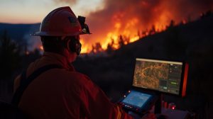
are enhancing wildfire management. Dr Zakary Campbell-Lochrie, Lecturer in Fire Science in the School of Engineering, is working with colleagues at the University of Edinburgh and national fire agencies to develop innovative modelling tools using the space data in a highly accessible and informative manner for key end-users such as fire agencies and land managers.
As a member of the Edinburgh Fire Research Centre, Dr Campbell-Lochrie built his expertise on characteristics of vegetation flammability and wildfire behaviour. He has developed innovative software tools for the prediction of wildfire behaviour based on laboratory and field experiment data. This multidisciplinary approach enables a deep understanding of fire propagation across various scales, ranging from small vegetation samples to complex fire experiments in wildland areas covering multiple hectares.
The technology has received backing from a range of fire agencies, notably the US Forest Service, New Jersey Forest Fire Service, and the Texas A&M Forest Service. Current technology development utilises satellite data to inform site-level decisions, particularly in nature conservation areas and key infrastructure locations. This work is supported by the University of Edinburgh's 'Living Lab' and Digital Research Services, enabling the creation of a novel database to improve predictions of fuel moisture and wildfire behaviour.

Groundbreaking development is underway to create an automated system for rapid fire detection and suppression. This innovative technology employs drone swarms and satellite data to swiftly identify and extinguish wildfires. The primary objective is to mitigate damage and risk to people and the environment by suppressing fires at an early stage. Additionally, the project investigates the efficacy of various suppression methods on different vegetation types, with the ultimate goal of enhancing wildfire management and prevention strategies. This innovative development, a collaborative effort with the University of Southampton, the University of Texas at Austin, and Texas A&M Forestry, has been selected as a semi-finalist for the prestigious £4M XPrize Wildfire competition.
The rising occurrence and severity of wildfires worldwide require the
creation of pioneering predictive tools and technological solutions to
manage wildfires effectively. The technology developed by Dr
Campbell-Lochrie is at the forefront of this effort, leveraging advances
in space data and Earth Observation capabilities to create modelling
tools and systems for quick-fire detection and suppression. This work
has the potential to significantly enhance wildfire management and
prevention strategies, ultimately reducing the risk to life, property,
and the environment.